Marshall Islands: history in brief
Atolls where navigators read ocean swells from charts made of sticks and shells.
Test yourself
Which came first?
History in brief
Ancient world Seafarers settled the atolls about two thousand years ago. To sail between them they learned to read the swell: charts of palm sticks and shells showed how waves bend around islands.
Early modern & modern era In 1788 the British captains John Marshall and Thomas Gilbert sailed past the islands, and the archipelago took Marshall's name. In 1885 Germany declared a protectorate and Jaluit became a copra trading centre.
Contemporary era On 21 October 1986 the Compact of Free Association took effect and the country became self-governing. In 1991 the Marshall Islands joined the UN. The capital is Majuro.
Interesting facts
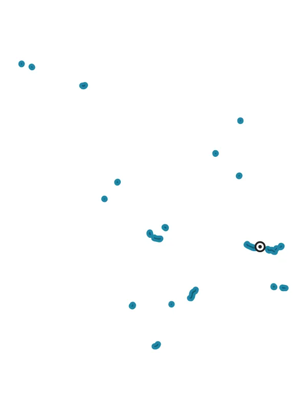
- The country has 29 atolls and 5 separate islands, more than 1,100 islands and islets in all.
- The country's highest point is only about 10 m above sea level.
- In Marshallese the word 'yokwe' means hello, goodbye and love.
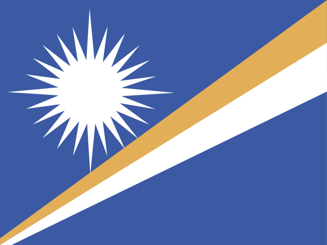
- The flag's star has 24 rays, one for each municipality; four long rays form a cross.
- On 17 September 1991 the country joined the UN on the same day as both Koreas, Estonia, Latvia, Lithuania and Micronesia.
5 questions of the day Where was it? Timeline
Eras
- Ancient worldbefore 476 · 178 events
- Middle Ages476–1491 · 206 events
- Early modern & modern era1492–1913 · 251 events
- Contemporary era1914 onwards · 217 events
History of countries
 Afghanistan
 Albania
 Algeria
 Andorra
 Angola
 Antigua and Barbuda
 Argentina
 Armenia
 Australia
 Austria
 Azerbaijan
 Bahamas
 Bahrain
 Bangladesh
 Barbados
 Belarus
 Belgium
 Belize
 Benin
 Bhutan
 Bolivia
 Bosnia and Herzegovina
 Botswana
 Brazil
 Brunei
 Bulgaria
 Burkina Faso
 Burundi
 Cambodia
 Cameroon
 Canada
 Cape Verde
 Central African Republic
 Chad
 Chile
 China
 Colombia
 Comoros
 Costa Rica
 Croatia
 Cuba
 Cyprus
 Czechia
 Denmark
 Djibouti
 Dominica
 Dominican Republic
 DR Congo
 East Timor
 Ecuador
 Egypt
 El Salvador
 Equatorial Guinea
 Eritrea
 Estonia
 Eswatini
 Ethiopia
 Fiji
 Finland
 France
 Gabon
 Gambia
 Georgia
 Germany
 Ghana
 Greece
 Grenada
 Guatemala
 Guinea
 Guinea-Bissau
 Guyana
 Haiti
 Honduras
 Hungary
 Iceland
 India
 Indonesia
 Iran
 Iraq
 Ireland
 Israel
 Italy
 Ivory Coast
 Jamaica
 Japan
 Jordan
 Kazakhstan
 Kenya
 Kiribati
 Kuwait
 Kyrgyzstan
 Laos
 Latvia
 Lebanon
 Lesotho
 Liberia
 Libya
 Liechtenstein
 Lithuania
 Luxembourg
 Madagascar
 Malawi
 Malaysia
 Maldives
 Mali
 Malta
 Marshall Islands
 Mauritania
 Mauritius
 Mexico
 Micronesia
 Moldova
 Monaco
 Mongolia
 Montenegro
 Morocco
 Mozambique
 Myanmar
 Namibia
 Nauru
 Nepal
 Netherlands
 New Zealand
 Nicaragua
 Niger
 Nigeria
 North Korea
 North Macedonia
 Norway
 Oman
 Pakistan
 Palau
 Palestine
 Panama
 Papua New Guinea
 Paraguay
 Peru
 Philippines
 Poland
 Portugal
 Qatar
 Republic of the Congo
 Romania
 Russia
 Rwanda
 Saint Kitts and Nevis
 Saint Lucia
 Saint Vincent and the Grenadines
 Samoa
 San Marino
 São Tomé and Príncipe
 Saudi Arabia
 Senegal
 Serbia
 Seychelles
 Sierra Leone
 Singapore
 Slovakia
 Slovenia
 Solomon Islands
 Somalia
 South Africa
 South Korea
 South Sudan
 Spain
 Sri Lanka
 Sudan
 Suriname
 Sweden
 Switzerland
 Syria
 Tajikistan
 Tanzania
 Thailand
 Togo
 Tonga
 Trinidad and Tobago
 Tunisia
 Turkey
 Turkmenistan
 Tuvalu
 Uganda
 Ukraine
 United Arab Emirates
 United Kingdom
 United States
 Uruguay
 Uzbekistan
 Vanuatu
 Vatican City
 Venezuela
 Vietnam
 Yemen
 Zambia
 Zimbabwe
Spotted a mistake or a disputed fact? Write to us and we will check and fix it: [email protected]